[su_tabs]
[su_tab title=”Overview” disabled=”no” anchor=”” url=”” target=”blank” class=””]
GEOGRAPHY
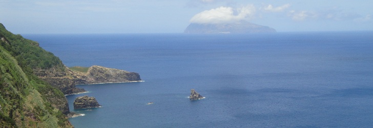
The smallest island of the Azores is 6.24 km long and has 3.99 km at its maximum width. This oval shaped island stretches from north to south and has an area of 17.1 sq. km, with 430 people (2011 data) living there. The island of Corvo and the island of Flores, 17.9 km away, make up the Western Group of the archipelago. The highest point of the island, at an altitude of 720 m, is located in the area known as Estreitinho at 39°41’58” latitude north and 31°06’55” longitude west.
HISTORY
The sighting of the island of Corvo by the Portuguese navigator Diogo de Teive might have occurred in 1452, at the same time as the discovery of the island of Flores. Given its small size, this island did not attract the attention of those who looked forward to settle in the Azores. Its natural, pure state was only broken during the 16th century, when the donatory-captain Gonçalo de Sousa sent a group of slaves, probably from Cape Verde, to Corvo to farm the land and breed cattle. In approximately 1580, some settlers who came from the island of Flores increased the local population.
Life in Corvo runs slowly and peacefully, guided by the rhythms of agriculture, fisheries and cattle breeding , to assure the survival of the community. But contrary to assumption, the geographical position of the island allows it to exceed its expected isolation. In fact, Corvo was the reference point where the Portuguese fleets came together to receive the ships coming from the various points of the Portuguese and Spanish Empires and, from there, to escort them safely to mainland Europe. Therefore, at the end of the 16th century and throughout the 17th century, this isolation was broken by the frequent arrival of privateers and pirates looking forward to pillage the land and to capture hostages. They faced a strong resistance in Corvo, and it is quite historic the defeat of the Barbary Corsairs from North Africa in 1632, with the locals throwing stones to repel the invasion. According to legend, in this hard and uneven battle, the local population was helped by the Saint Nossa Senhora do Rosário (Our Lady of the Rosary), who “deflected the bullets fired by the pirates and returned them, in multiple figures, back to the ships of the Moors, thus dispersing them.” Since then, this saint became known as Nossa Senhora dos Milagres (Our Lady of Miracles).
The bravery of the inhabitants of Corvo became once again evident in 1832, when a group of men went to the island of Terceira to plead for the relief of the heavy tax levied by the donatory captain of the island and by the Crown. Mouzinho da Silveira, a minister of King Pedro IV, who was at the time organising the liberal wars from Angra, was impressed with the enslavement faced by the local population. Thus, he proposed the cancellation of the tax paid in cash and a reduction in half of the payment made in wheat. During this very year, the locality was given a town charter and its name was changed to Vila do Corvo (Town of Corvo).
During the 18th and 19th centuries, American whaling boats arrived at the coasts of the islands of the Western Group. Some locals were recruited to hunt sperm whales, and they earned the reputation of being very courageous harpooners. In 1864, Corvo had almost 1,100 inhabitants, but this figure started decreasing from then on. Between 1900 and 1980, Corvo’s population decreased from 808 to only 370 inhabitants, with this reduction being mainly caused by emigration to the United States and Canada.
In 1983, the opening of the airport of Corvo was crucial to modernise the island’s infrastructure. Since 1991, the operation of scheduled flights from the islands of Flores, Faial and Terceira has contributed to the full integration of the island into the Archipelago. Agriculture, centred on cattle breeding, is the current mainstay of the local economy.
[/su_tab]
[su_tab title=”Nature” disabled=”no” anchor=”” url=”” target=”blank” class=””]
THE BLACK ISLAND
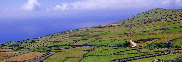
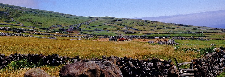
The landscape of Corvo is filled with black stone walls that divide properties. The barns, built with basaltic rock, are used to store the tools used in farming and fodder, and they add to the black stain that gave origin to the colour attributed to this island.
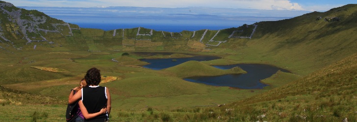
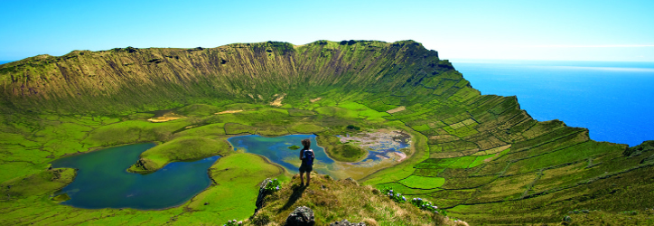
The entire island of Corvo corresponds to a main volcanic struture, with a caldera at the top (called Caldeirão) and about twenty secondary volcanic cones on its flanks and inside the caldera. It is thus a “volcano-island”, the only one in the archipelago with these features.
The island’s landscape is dominated by green semi-natural pastures and dark stone walls that divide properties. Here and there, one sees barns with basalt walls, used to store the tools used in farming and fodder. The landscape has a reduced forest density, although we do come across Azores heather and Azores juniper (which is locally called zimbro), and there are several orchards with fruit trees, especially on the east side of the island. In the outskirts of Vila do Corvo, the only town on the island, agricultural fields are a common sight.
With the aim of contributing to the socioeconomic development of Corvo and of its people, focusing on the conservation of the island’s environmental and cultural heritage, the Biosphere Reserve of Corvo was established in 2007.
VOLCANIC LANDSCAPE
The Caldeirão is the main element of the island’s landscape and resulted from the collapse of the top of the central volcano of Corvo. This volcanic caldera has an elliptical shape, with a maximum diameter of 2.3 km and a depth of 305 meters. Its interior is filled by a shallow lake and several small volcanic cones that cut the body of water and that, many claim, outline the drawing of the Azores Islands. From the Caldeirão lookout, it is possible to see this vast volcanic depression and enjoy the quiet calmness that characterises this remote part of Europe.
Vila do Corvo is located in a lava fajã [flat area of land by the sea], which is the island’s main flat surface and which had its origin in basaltic lava that flowed from the Morro da Fonte, a scoria cone overlooking the town. The flow that formed this fajã is currently best seen along the coast, particularly in the form of coastal lava ridges. These ridges are visible between the Portinho da Areia and Ponta Negra and have an underwater extension (the so-called caneiros), a location of choice for divers who come to the island. The island’s last eruptive event occurred precisely in this fajã some 80,000 to 100,000 years ago and formed the basaltic lava flow that stretches from the area of Pão de Açúcar to the Alto dos Moinhos.
COASTLINE
The entire island is surrounded by high, steep cliffs, especially in the north and west, due to the strong sea erosion it suffers and to the detrital nature of its volcanic formations. This erosion causes major rock and landslides and uncovers many basaltic dikes that cross the host formations, resulting in dense, complex and capricious sequences of intrusive formations.
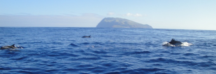
A boat trip around the island is an unforgettable experience, revealing its most inaccessible areas and allowing you to see beautiful landscapes and a large number of seabirds and some marine vertebrates, such as dolphins and whales.
[/su_tab]
[su_tab title=”Activities” disabled=”no” anchor=”” url=”” target=”blank” class=””]
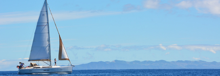
This paradise is internationally known as a bird watching location andit is the habitat of many bird species, such as terns, shearwaters and Azores wood pigeons. The migratory birds of North American also feed in this small location in the middle of the ocean, whilst resting from their long crossing flight.
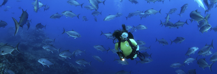
Diving has experienced great progress on the island given the abundance of excellent spots and the effort made to preserve the diversity of the existing types of fish. Boat rides around the island are included in the available sea activities. Swimming is also available at the beach of Praia da Areia and at Porto da Casa, on an island that offers good walking and bicycle rides.
[/su_tab]
[su_tab title=”Heritage” disabled=”no” anchor=”” url=”” target=”blank” class=””]
ARCHITECTURE
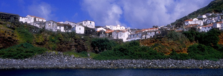
The only settlement of the island, Vila do Corvo, has intertwined narrow streets for a better protection against the strong wind that is common on the island. The streets, paved with black cobblestones, are flanked by houses painted in white, but there are still some houses with walls made of black basaltic rocks. The square Largo do Outeiro is the centre of the town. Locals and visitors alike get together on the black stoned benches to share stories of current affairs or about the past. The façade of the church, dedicated toNossa Senhora dos Milagres, faces the ocean. It was built in 1674 and rebuilt during the 18th century. Inside, there is a Flemish statue of the patron saint of the island.
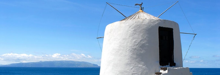
By the Alto dos Moinhos, next to Ponta Negra, small windmills adorn the seaside. Of a solid standing, they add white dots to the deep blue horizon, with the profile of the island of Flores coming to view further away. A mechanical device rotates the wooden cupola so that the sails follow the direction of the wind. They are the reminders of just how important the production of corn and wheat was on this island.
CULTURE
The Corvo Environmental and Cultural Interpretation Centre, recently built taking advantage of some of the town’s typical houses, is a must visit place. At this modern facility, in addition to a pleasant and relaxed conversation, you can appreciate and learn more about the island and its particularities and about the local population and its experiences.
HANDICRAFTS
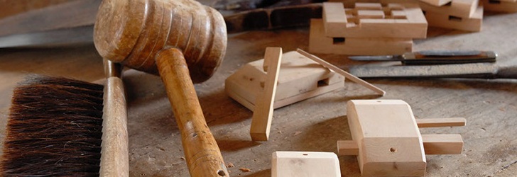
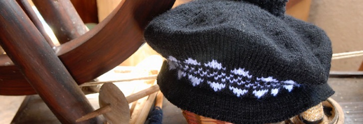
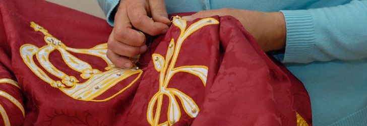
The wood door locks, which are still hand made by the artisans of the island of Corvo, are the symbol of the tranquil, peaceful life style of this island, wherein all know one another. Besides being useful, the wood locks are the craftsmanship that most sets Corvo apart. The woman do crocheting, embroidering and objects made from shells.
[/su_tab]
[su_tab title=”Festivities” disabled=”no” anchor=”” url=”” target=”blank” class=””]
In spite of only having a handful of inhabitants, the Holy Ghost Festival remains very much alive around the colourful chapel of Vila do Corvo, which dates back to 1871. On 15 August, there is dancing and religious ceremonies in honour of the Saint Nossa Senhora dos Milagres. The Festival dos Moinhos (Windmill Festival) is included in these celebrations, and it brings together the local brass band and brass bands from other islands to entertain the population for a couple of days. In September, the festivities celebrating the end of summer also include the dances that are held after the procession in honour ofthe Saint Nossa Senhora do Bom Caminho.
[/su_tab]
[su_tab title=”Food & Drinks” disabled=”no” anchor=”” url=”” target=”blank” class=””]
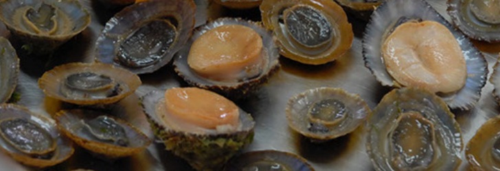
The local cuisine is mainly based on the freshness of the products fished in the sea or picked from the land, with fish and seafood standing out.
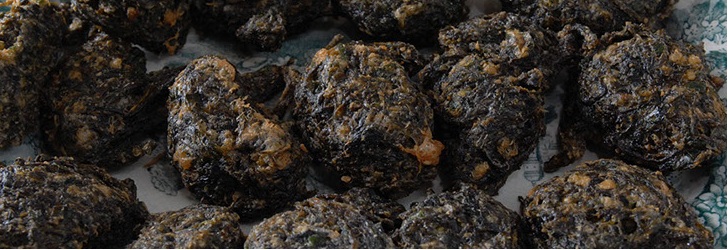
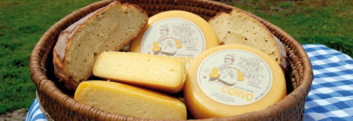
Corn bread is locally baked and is served with typical dishes such as the tart erva do calhau (rock grass). The grass is a type of seaweed picked from the sea rocks and the salt water is squeezed off. After it has been cut, it is added to eggs that have been beaten and flour to mould the small tarts, which are then fried in lard.
In the so-called couve de barça recipe, also known as kale and fresh pork meat, the meat is salted the day before it is cooked with thinly cut cabbage, potatoes, onions and garlic, and is served with sweet potatoes and corn bread.
The handmade cheese of Corvo, which cures for at least 60 days, is very much appreciated. It features a semi-hard paste and is yellow in colour, with a persistent and slightly hot taste.

