[su_tabs]
[su_tab title=”Overview” disabled=”no” anchor=”” url=”” target=”blank” class=””]
GEOGRAPHY
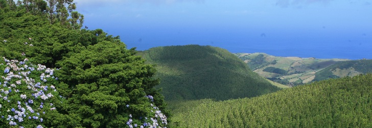
The island of Flores is 16.6 km long and has 12.2 km at its maximum width, which translates into a surface of 141.4 sq. km. Together with the island of Corvo, which is 17.9 km away, it forms the Western Group of the Azores Archipelago. The European Continent has its westernmost point on this piece of land where 3 793 people live (2011 data). At an altitude of 911 metres, the Morro Alto is the island’s highest point and is located at 39°27’48’’ latitude north and 31°13’13’’ west.
HISTORY
The Portuguese discovery of the islands that form the western group probably took place sometime in 1452. It is believed that Diogo de Teive was the navigator responsible for the finding of this “far away” land. The name Flores (Flowers) is believed to be associated to the abundance of natural flowers that the island showcased as soon as the 1470s. It was not an easy task to try and populated the island. Actually, the geographical uniqueness of the Western Group is mirrored in its political structure, because unlike the other islands, Flores and Corvo constituted a single fiefdom that King Afonso V handed in 1453 to his uncle D. Afonso, Duke of Bragança and Count of Barcelos.
The first efforts to settle Flores were also carried out by the Flemish, namely by Willem van der Haghen, who had initially settled on the island of São Jorge and then tried to settle on a land located further to the west around 1480. Whether it was the disappointment with the island’s economic potential or its isolation from the rest of the archipelago, the truth is that the experience failed and the Flemish returned to São Jorge. The island of Flores was abandoned for many years, and there is only evidence of a successful settlement in 1508 thanks to the efforts of the Fonseca family. Despite the late settlement, there was a sustained demographic growth. Lajes das Flores was granted a town charter in 1515, with Santa Cruz das Flores obtaining it in 1548. From the late 16th century, the activity of the Mascarenhas will further boost the demographic development of Flores.
In a similar fashion to the rest of the archipelago, the economy was based on cereals for about two centuries, as well as on sheep breeding, the production of cloth and fishing.
During the 16th and the 17th centuries, the island lived in tranquillity and isolation, a condition that was threatened by the frequent and unwelcomed visits of privateers. As Europe’s westernmost point, Flores had a highly relevant tactical position and functioned as a strategic location for the logistic support that the Crown provided to ships arriving from the Pacific and Indian Oceans. Consequently the island was closely watched by privateers and pirates, whilst they quietly awaited the passing of Spanish galleons filled with precious metals from the Americas and Portuguese carracks from the East.
In the 19th century, Lord Alfred Tennyson perpetuated in the poem The Revenge this bygone time of sea adventures and pillages. “At Flores in the Azores Sir Richard Grenville lay” opens the description of the heroic defeat, at the hands of the Spanish fleet, of the ship captained by Sir Richard Grenville, an English privateer. By the mid 18th century, Flores became a safe harbour for the English and North-American whaling fleets, looking for supplies and sailors. This external influence required the construction of bases for the hunting of sperm whales at Lajes das Flores and Santa Cruz das Flores. There are still vestiges of these premises, which were then built for the extraction of oil from the whales.
The opening of the airport in 1972 and the construction of modern ports led to a greater integration of the Western Group in the Azores Archipelago. The services sector now supports the island’s economy, employing about 60% of the local workforce, with tourism playing an increasingly larger role.
[/su_tab]
[su_tab title=”Nature” disabled=”no” anchor=”” url=”” target=”blank” class=””]
THE PINK ISLAND
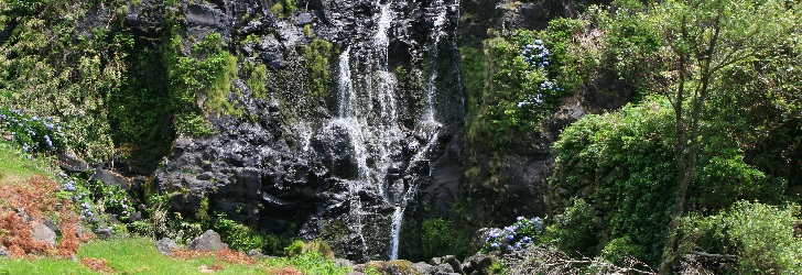
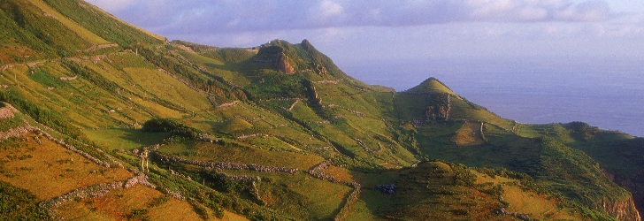
The undulating central massif of volcanic origin dominates the whole landscape. Cones with smooth slopes rise from the top of this plateau, where craters with sharp, rocky walls have been transformed in lakes. These are the remains of a once rebellious Nature that now welcomes visitors with kindness. From the summit of the hill Morro Alto, one can see an intense green ocean where the native laurissilva forest is still present. Among the intense greens of the vegetation, there are outstanding waterfalls and streams that water a natural garden of colourful flowers, where the pink of the azaleas and hydrangeas stands out.
VOLCANIC LANDSCAPE
Craters, lakes and streams dot the landscape of Flores. The water of the streams flows either lazily at the surface in the central plateau or quickly at the waterfalls and along the long, deep valleys. And before reaching the ocean, it is still powerful enough to move the turbines at the island’s several hydroelectric power stations.
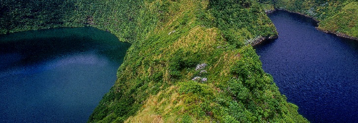
The island features seven volcanic craters that have changed into beautiful lakes. Despite being very close to each other, the Caldeira Rasa and the Caldeira Funda, slightly to the south, are located at different heights. The luxuriant vegetation and the bunches of flowers on the slopes are the natural setting of the island. Nearly at the island’s centre, there are the craters: Caldeira Branca, Caldeira Seca, Caldeira Comprida, and Caldeira Negra (or Funda), the latter with a depth of 105 metres and a special shade of blue. Isolated from the others, the Caldeira da Lomba is surrounded by a small hill and hydrangeas.
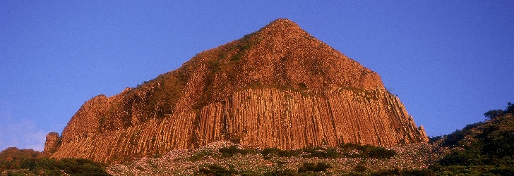
One of the most famous monuments of the Azores, the rock Rocha dos Bordões is made up by a large set of vertical basalt columns. The prismatic or columnar jointing resembles a pipe organ and stands out at the top of a hill. Covered by moss, lichen and other vegetation, the basaltic rock changes its colour throughout the day as if requesting our eternal return to this site.
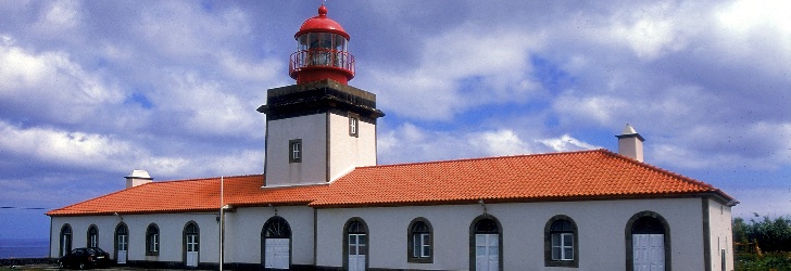
More geological formations with peculiar shapes can also be seen at the hill Morro dos Frades, where some see on the rock the shadows of a friar and a nun. Even more symbolic, the Monchique Islet represents the westernmost piece of land of the European Continent. Seen from Vigia da Ponta Negra, close to the Albarnaz Lighthouse, this black rock puts a full stop to Europe and serves as a foreword for the discovery of an island and of an archipelago.
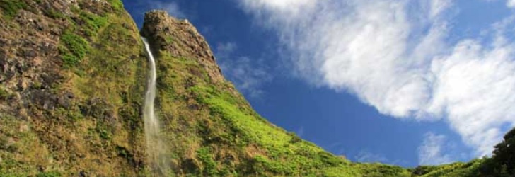
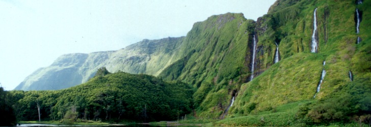
The area between Fajãzinha and Fajã Grande is one of the most beautiful coastlines of the Azores. Through the long green wall that borders this area, there are almost twenty waterfalls, with the one named Ribeira Grande standing out given its 300 metres height. At the foot of the cliff, there are several permanent puddles, such as the Poço do Bacalhau and the Poço da Alagoinha, which is also known as Lagoa dos Patos. A walk to the cliff provides you with the opportunity of enjoying from a close distance the waterfalls and the scenery that Nature has carved out, which is an invitation to contemplation and to a reinvigorating swim. There is the dark grey colour of the rock, the green of the luxuriant vegetation, the white from the foam and the crystal blue of the water that come together to offer a most prodigious view.
COASTLINE
Countless islets, headlands, shoals, inlets, coastal caves, prismatic jointing, waterfalls, and impressive valleys are some of the particularities that the coastline of Flores has to offer. Adorning the high cliffs of the south coast, Fajã Nova at the Ponta da Rocha Alta and Fajã de Lopo Vaz can be reached through a walking trail carved along the cliff.
On the island’s north coast, the low and linear coastal cliff between Ponta Delgada and Ponta do Albarnaz gives way to the insurmountable terrain of the island’s northwest coast, which can only be crossed through walking trails, such as the one between the lighthouse at the Ponta do Albarnaz and the Ponta da Fajã. It is a difficult trail but it affords breathtaking views.
On the other hand, at the lava fajãs of Santa Cruz, Lajes and Fajã Grande, the sea softly embraces the low rocky tips of black lava, and on calm days, it highlights a glittering seafloor titillating with life.
[/su_tab]
[su_tab title=”Activities” disabled=”no” anchor=”” url=”” target=”blank” class=””]
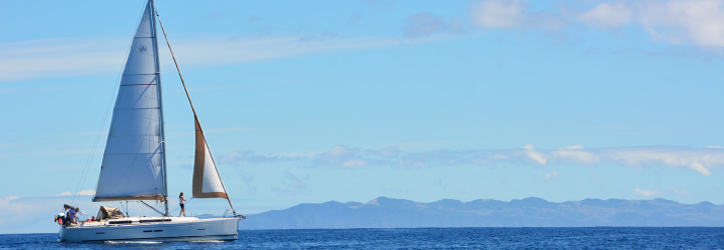
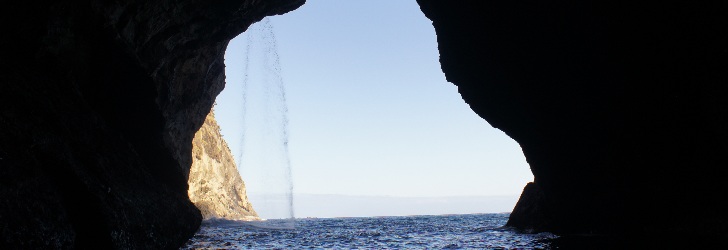
The magnificence and diversity of the coastline of Flores justify a long boat ride. The Arco de Santa Cruz das Flores and the Maria Vaz Islet can only be reached from the sea, as well as the entrance to the Gruta dos Enxaréus, a 50 meters long volcanic cave. It is easy to cross the ocean that links this island to the island of Corvo. There are various companies that promote this trip to discover the small island seen on the horizon from the northeast coast of Flores. The natural tidal pools of Santa Cruz and the beaches near Lajes das Flores are good for swim, along with the pebbled beach of Fajã Grande. Swimming is also possible in the ponds formed by the waterfalls at Poço do Bacalhau and Ribeira Grande.
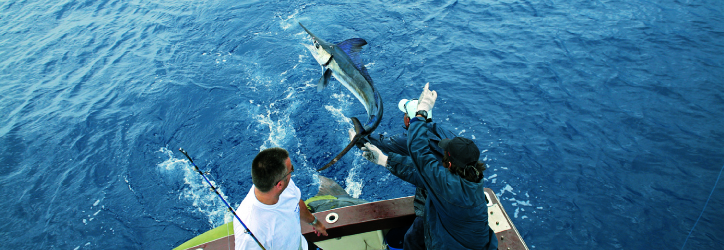
Diving and whale watching are also available in Flores, which offers very good conditions. Fishing can be done from the top of a rock, in the sea or in the streams filled with trout. On land, holding a proper licence, wild chickens and rabbits can be hunted. The island is one of the best places of the Azores for watching birds such as the goldcrest and the blackcap, and is a true sanctuary for native and migratory species, especially from the American continent.
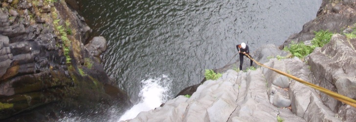
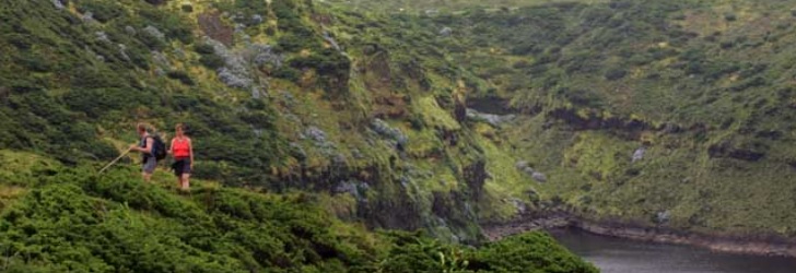
As there are many streams and waterfalls on the island, canyoning is becoming very popular. There are at least a dozen sites for this sport, and courses are also available for beginners who have never tried this sport but wish to experience an adrenaline rush whilst contacting with nature.
[/su_tab]
[su_tab title=”Heritage” disabled=”no” anchor=”” url=”” target=”blank” class=””]
ARCHITECTURE
Throughout the island there are various churches that stand out for the white of their walls surrounded by the predominant and unavoidable grey of the stonework. The Nossa Senhora de Lurdes Church, built in the 20th century, is special because it takes advantage of a hill in order to be seen and, simultaneously, it works as a lookout over the surrounding fields and trees. It is equally from a lookout over Fajãzinha that one can view all of the parish’s houses lost in the middle of a green plain.
In Santa Cruz das Flores, the Nossa Senhora da Conceição Church stands out from the other buildings because of its grand façade, and the narrow streets of the town are a reminder of the past. The central Marquês do Pombal Square features a colourful Império (Holy Ghost Chapel) and a walk down to the harbour provides new chromatic experiences given the colourful fishing boats. From the lookout at the hill Monte das Cruzes, the whole town can be seen.
In Lajes das Flores, the Nossa Senhora do Rosário Church stands out. It was built in the 18th century, with its façade being subsequently covered with tiles. From the church square, surrounded by araucarias, there is a view over the port and part of the town, and it can be the starting point of your discovery of the impérios (small Holy Ghost chapels), of the basaltic stone houses and of the bridge, dating back to 1743, over the stream at Ribeira dos Morros.
CULTURE
Located in a section of the old São Francisco Convent in Santa Cruz, the Flores Museum documents the relations of the people with the land and the sea. There are collections on the exploitation of farms, scrimshaw and maritime tools, along with tools used in carpentry, steel works, cotton and wool textiles. The collection recovered from the Slavonia, a ship wrecked on the coast of Flores in 1909, is quite curious.
HANDICRAFTS
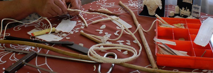
The flower arrangements made from the pith of hydrangeas are a delicate work that requires firm and skilled hands. The tradition of the island also includes flower arrangements made from fish scales, objects made out of shells, embroideries and crochet. The wood miniatures resemble farming tools.
[/su_tab]
[su_tab title=”Festivities” disabled=”no” anchor=”” url=”” target=”blank” class=””]
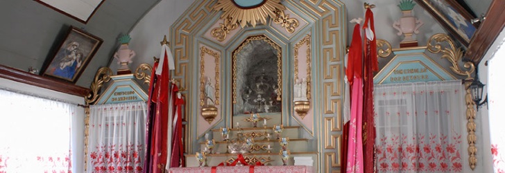
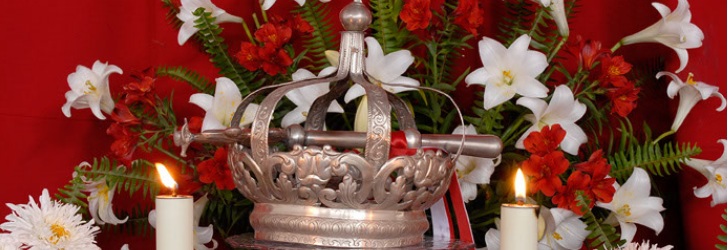
The Festival of the Emigrant is celebrated to pay homage to those who left the island looking for a better life, but who come back to their homeland every year. The popular festivities and the meetings of old friends are the tune played during the month of July. In the previous month, on the 24 June, the locals also celebrate the São João Festival. The devotion to this patron saint goes back to the time of the settlers who came from the island of Terceira, and it has been kept alive and strong throughout the centuries. In a similar fashion to the rest of the archipelago, the Holy Ghost Festivals take place from May to September. This cult is especially and colourfully celebrated at Santa Cruz given the arches of flowers that decorate the streets.
[/su_tab]
[su_tab title=”Food & Drinks” disabled=”no” anchor=”” url=”” target=”blank” class=””]
The islands of the western group remained isolated for centuries, given their distance to the other islands of the archipelago and the inclement weather that sometimes hit them. As such, the inhabitants learned to rely on the local production for their staple diet.
During the winter months, when the fishing boats could not go fishing in the abundant sea, a lot of pork was eaten. Pork dishes remain as witnesses of those times. The salted pork meat is cooked and served with potatoes and cabbage. Taro root with sausage and water-cress soup can also be included in the most traditional recipes of Flores. The dried cheese produced on the island features a soft paste with a firm texture.
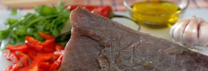
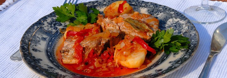
The surrounding sea is generous and stimulates the food imagination of the local people. The tarts tortas de erva patinha bring together the concept of an omelette served with algae that grows on the shores. Fish is part of the cuisine heritage of the island and is served in recipes such as roasted tuna and stewed conger eel.
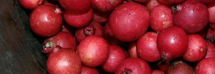
In some localities, the microclimate favours the growth of exotic fruits. From the guava tree, yellow, red and purple fruits are picked to make a local dessert. The honey is imbibed with the aroma of the thousands of flowers that embellish this island.

